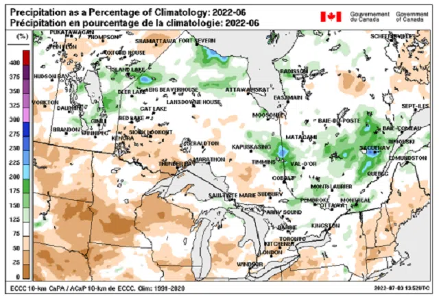
Environment Canada meteorologists are out with their June climate review for the Province, and report that the month was drier than usual- with the exception of Eastern Ontario.
On June 1st: Heavy Rainfall in Eastern Ontario began the month as a slow-moving cold front ushered in heavy rainfall with many areas north of Lake Ontario and eastward received rainfall amounts generally in the 20 to 40 mm, with locally higher amounts of near 60 mm in a corridor from Kingston north to Tamworth.
June 16th was marred by severe thunderstorms in Central and Eastern Ontario, which developed ahead of and along a cold front sweeping across southern Ontario eastward.
Reports of large, toonie to ping pong ball sized hail were received in the GTA.
Downed power lines and utility poles, and uprooted trees afflicted many areas resulting in prolonged power outages.
A team from the Northern Tornadoes Project (NTP) assessed damage in Belleville, Shannonville and Mallorytown, and in each case determined that damage was a result of EF-0 downbursts.
There were two official tornadoes that day, both EF-0; one in Carleton Place and another in Brooklin.
For July, cooler than normal temperatures are anticipated for the first half of the month before a switch back to seasonal for the latter half. Near normal precipitation is expected through at least the first half of
the month.
By Environment Canada- edited by Rick Stow


